|
Parish 6 |
Date of Agreement / Award |
Date of Confirmation of Apportionment |
Oborne |
30/6/1838 |
29/6/1839 |
|
Date on Map |
Scale of Map |
Valuer Map Maker |
|
1838 |
6 chains |
Robert Wright of Norwich John Martin |
|
Signature |
||
|
Robert Wright Norwich [original] John Martin [copy]. |
Bincombe [next below] and Oborne were two parishes surveyed by Martin that were owned, almost exclusively, by the Cambridge College of Gonville and Caius, apparently having gained the lands from the former monastery at Sherborne Abbey when it was dissolved. The apportioner in both parishes was a surveyor and estate agent [according to the National Archive] from Norwich called Robert Wright. We can imagine that the Master and Fellows were not going to let just anybody apportion their tithes, particularly when they were so far distant from the parishes. Interestingly there were no moduses in the parish and the tithe [£168] was payable in it’s entirety to the vicar John Parsons. There are no records in the diaries relating to Oborne and apart from the initial meeting called by Parsons, no newspaper notices of the apportionment. Martin visited Oborne in 1810 to buy vellum but there are no mention of vellum sellers in the apportionment.

Oborne.
Michael Hanson has noted the original map was signed by ‘Robert Wright of Norwich Del’ which stands for “delineavit” – ‘drew this’ in the lower right corner.[1] It is likely that he wished to impress his employers in this early commutation and justify his fee. Martin however appears to have made the copy, it is certainly signed by him and there are marked stylistic differences between the maps. The copy map is the more interesting of the two, one is tempted to see the influence of Mr Watt’s of Yeovil in it. The original map has an ornate star cartouche drawn so as to give the impression of a swirling motion, the copy map has a plain star cartouche. The North orientation on the copy map seems to be orientated slightly more eastwards than on the original map. This has plain field boundaries whereas on the copy map the hedgerows are drawn in the manner of inclosure maps. That is to say the hedge is shown pointing into the field whose owner has the responsibility of maintaining it. The arable fields are of some interest. It is not uncommonly found in real fields that there are dips in the terrain which were not ploughed. On most maps where these occur the whole field is just shown as arable but on the Oborne map they are shown as what can only be described as flecks of pasture shaded in green. There is one curious feature on both maps. There are areas on them where it would appear that some data had been entered and then subsequently erased. On the original map the appearance is similar to that of a child’s crayoning and is in the centre of the map. The area erased on the copy map is bounded by I I lines and is similarly smudged but is to the right of the map. It is not clear what these areas contained since there would have been no necessity for the landowner to have certified the map for there was only one significant landowner – The Masters and Fellows of Gonville and Caius. Presumably the copy and original map were made at the same time and then the areas erased. I cannot believe that they would have copied an erased area deliberately.
The copy map bears two date stamps one in the upper left hand corner which though faint reads 22nd October 1838. The second one at the lower left corner is illegible.
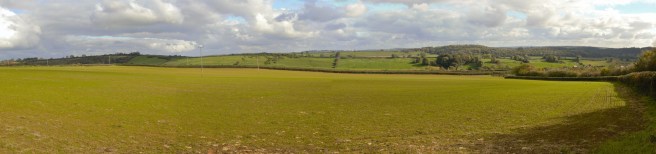
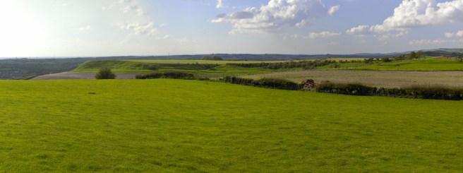
The country around Oborne.
|
Parish 7 |
Date of Agreement / Award |
Date of Confirmation of Apportionment |
Bincombe |
3/7/1838 |
27/6/1839 |
|
Date on Map |
Scale of Map |
Valuer Map Maker |
|
1837 |
6 chains |
Robert Wright of Norwich John Martin |
|
Signatures |
||
|
John Martin Surveyor [original] Robert Wright of Norwich [copy] |
Note this is the reverse of the signatures on the Oborne map. |
Both Bincombe and Robert Wright were well known to Martin as he was the surveyor to the inclosure there in 1832, and Wright was one of the commissioners. This time, despite what Robert Wright might have claimed with his ‘DEL’ on the copy map, the appearance of the maps are very very similar and entirely in keeping with John Martins style. He was for example almost unique amongst Dorset tithe map makers in using topographical shading [hachuring] to depict hills and valleys on his maps. He did not always do this but both original and copy maps demonstrate this. Although the titles on the maps differ, being in two hands, other features, in particular the depiction of hedge rows are the same on both maps. Curiously both maps are dated 1837, a year before the agreement was reached and whereas the title of the Oborne map is the standard “Map of the Parish of Oborne Dorset” the title of the Bincombe map proclaims its ownership, ‘Map of the Parish of Bincombe Dorset The Property of the Master and Fellows of of Gonville and Caius College Cambridge 1837’. It is almost certain that the map was based on the inclosure map.
Bincombe
The original map is signed John Martin Surveyor [type 1 signature] in the bottom right corner and endorsed by Aneurin Owen with his signature. The copy map has neither but has the ‘signature’ of Robert Wright Norwich’ in the bottom right corner. This is a direct reversal of the Oborne map. Although the body of the maps are similar they are not exactly so. Most maps were surrounded by an ink line “frame”; on the original map the right lateral edge of the parish goes through this to the physical edge of the map. On the copy the whole parish is encompassed within the ink frame. The North Arrow is a different style on both maps: on the original a simple fleur-de-lis style on the copy a complex compass rose style. There is only one entry which refers to Bincombe in the Diaries and it predates the agreement made in July. All of this suggests that Martin had been approached by the Master of Gonville & Caius and done much of the ground work for the commutation before the process had formally got underway.
|
20th March 1838 |
Sent Mr Tooks of Sherborne my Office Copy of Particulars of Bincombe and went to Batcombe £1 1s 0d in the afternoon |
1 M Hanson Somerset and Dorset Notes and Queries March 2016
