Bridport First District
The responsibility for maintaining the roads that passed through the parishes lay with the parishes themselves. By the 19th century there were three ways of doing this. The first was to demand each man in the parish to provide six days unpaid labour. This was inconvenient and demeaning to some, so an act of parliament in 1692 [The Highway Act] allowed a parish rate of up to six pence in the pound to be levied in order to pay somebody else to do the work. This was known as the way or way warden’s rate. Finally, at least from evidence we have at Evershot, the poor rate was also used to supplement a semi-permanent workforce to maintain the roads.
Until the 17th century most roads were used for little more than internal and inter-parochial traffic. If livestock were moved long distances the system of drove roads was most likely to be used, but these tended to avoid centres of population and as far as I have been able to determine were never maintained by the local communities.1 There was little incentive for a parish to maintain roads from which they would not directly benefit and in the 1640’s at a small village in Hertfordshire called, Standon the matter came to a head.2 The parish was responsible for a section of what is now the A10 and the Vestry considered that the amount of statutory work demanded to repair it was excessive. They requested the ability to raise a tax on heavy loads but the local justices of the peace declined. Nothing daunted the parish persisted in its claims for a tax for several decades and in 1663 Parliament authorized them to raise tolls on traffic passing through the parish. The first Turnpike Trust had been formed.
It set a pattern for all future infrastructure projects [as we would now call them] in England and Wales: canals, turnpikes, inclosures and railways could not generally proceed without a private act of parliament. In part this was a response to the infamous South Sea Bubble; parliament wanted no more companies, “for carrying out an undertaking of great advantage, but nobody to know what it is”. They wanted well thought out and planned companies who stuck to their remit. As with the railways [see below] the turnpike acts allowed the trust to raise money, in the case of the turnpikes from from issuing bonds whose interest and eventually capital was to be paid from the tolls they were entitled to charge. This was important for although the turnpikes occupied many thousands of acres, they never owned it; it was, after all, the Kings Highway. A turnpike trust could have several hundred trustees all of whom were unpaid but three paid officials did the work, the clerk, treasurer and surveyor. John Martin acted in that capacity to at least four turnpikes.
As with all infrastructure projects the process started with a petition laid before parliament by interested parties requesting that a bill be introduced before the house for the turnpike concerned. Such petitions usually emphasised the problems the project was intended to remedy whilst minimising the problems that the solution might cause. If the petition was accepted a number of MP’s would be selected to oversee the introduction of the bill, the details of which had probably already been prepared by the promoters of the project beforehand. For the surveyors to these projects there was always a considerable amount of work to be done preparing the details to be included in the bill which in the case of the turnpikes canals and railways would have included the intended route.
There is little doubt that the turnpike trusts revolutionised travel. Isochrone3 maps prepared by the Cambridge Group for the History of Population and Social Structure show that in 1680 it took ten hours just to get to the outskirts of London from the centre, thirty hours to get to Portsmouth, over fifty hours to get to Bristol, Birmingham, Nottingham and Norwich and a massive one hundred hours to get to Manchester. By 1830 turnpikes had reduced these time to ten hours to Portsmouth, fifteen to Bristol, Birmingham etc and twenty five to Manchester.
The early diaries record Martin making use of the turnpikes to travel to and from from places such as Bishopstone but the first entry for him being involved with the turnpikes professionally comes from 1821 and is not very revealing,
| 26th March 1821 | Dined at the Turnpike Meeting Acorn |
On the other hand in April and May he was paid for work under taken on the “Bridport Turnpike”.
| 26th April 1821 | Went to Bridport Respg Loder &c
Received of Mr Templer bill on Bridport Turnpike £32 10s 0d |
| 1st May 1821 | Pd for Stamp receipt when reced Bill on Bridport Turnpike 1s |
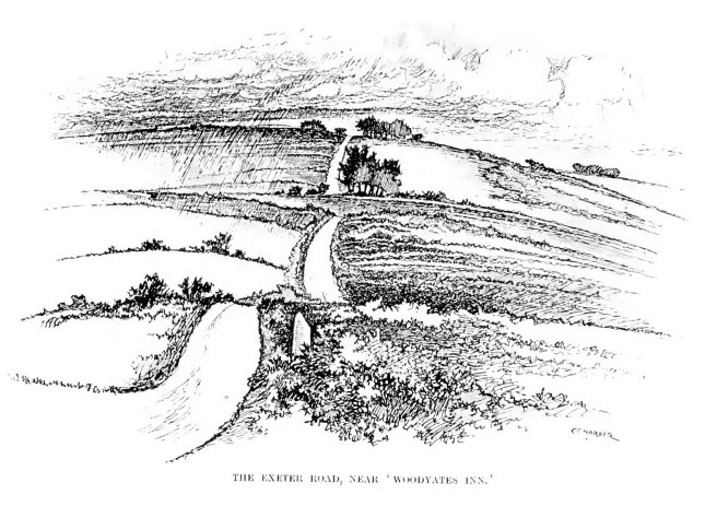
Two turnpikes ran through or to Bridport. The first was created from what was previously the Great Western turnpike and extended from near Lyme Regis to Bridport and was known as the Bridport First District4 Trust. Heading east it connected to a trans-Dorset turnpike which passed through Dorchester and then headed north east through Blandford and continuing in the same line ended at Harnham Hill near Salisbury. This was the old Exeter Road, rebranded near Salisbury as the Harnham, Blandford and Dorchester turnpike. Like the turnpike that now forms the current A30 from Salisbury to Yeovil and then west to Exeter, it’s importance grew after 1549 when rebellion broke out at Exeter and a rapid route to the west country was needed. In 1690 it offered a mail service by wheeled cart to Exeter whereas the route through Sherborne and Yeovil was by packhorse only. 5 Martin was involved with the Bridport section of the turnpike as the accounts from May 1845 shows he did some work on it although he does not record what.
| 17th May 1845 | Reced my Bill for Valuing for Harnham Turnpike £3 10s |
Being an important centre for the production of rope and sail cloth, good communications were important for the town. The east/west direction was adequately catered for and heading north another turnpike was started in 1765 known as the Bridport Second District Trust. It took a northerly route towards and through Beaminster where there was an equally thriving hemp and cloth manufacturing industry. It was this trust that he was working for in 1827.
The first entry from 13th November refers to him going with a Mr Cox and it would be nice to think it was Samuel Cox who was treasurer of the trust but the contraction of Mr Cox’s name does not look like Samuel or indeed Benjamin as he refers to further down the entries.
| 13th November 1827 | Went to Beaminster respg Turnpike and Viewing intended alteration with {? Esq} Cox |
| 14th November 1827 | At Beaminster for Measuring and Map[ping] Roads done but little on Acct of Rain |
| 15th November 1827 | At Beaminster Measuring Roads &c |
| 19th November 1827 | At Beaminster upon the New intended Road |
| 23rd November 1827 | Do returned Home |
| 27th November1827 | At Beaminster upon the New intended Road |
| 28th -30th November1827 | Do |
| 4th December 1827 | Plotting Beaminster Roads Plan |
| 6th December 1827 | Plotting Beaminster Roads Plan |
| 7th December 1827 | Do making Section |
| 8th December1827 | Do |
| 9th December1827 | At Home |
| 10th December 1827 | Beaminster for Roads making Section
Pd for drawing Paper 5s |
| 11th December 1827 | Do |
Beaminster is surrounded on most sides by large hills which achieve a height of over two hundred metres above sea level. The biggest barrier to traffic heading northwards was Horn Hill and at some stage it was decided to build a tunnel under it. The principle instigator for the project was a local solicitor called Giles Russell who was father in law to Samuel Cox the of the Bridport trust. Martin was involved in some part of the surveying and planning stage presumably helping to work the project up for presentation to the ‘commissioners’ on the 27th December.
| 12th December 1827 | Do ½ a day making Fair Plan
Pd for more Drawing Paper 7s6d |
| 17th December 1827 | Went to Beaminster on the Road Estimate |
| 18th December 1827 | At Beaminster on the Estimate |
| 19th December 1827 | Do and returned home in the evening |
| 20th December 1827 | Completing Plans and Sections |
| 21st December 1827 | Do |
| 22nd December 1827 | Ascertaining Expense of Tunnel &c |
| 23rd December 1827 | At Home working all day on the Beaminster Turnpike |
| 24th December 1827 | At Beaminster with Benj Cox on the Estimate |
| 25th December 1827 | Working the whole of this day Beaminster with Benj Cox on the Estimate
Paid my Bill at the White Hart Beaminster for self Benj Cox &c see Back for Servants £8 |
| 26th December 1827 | At Home making out Fair Estimate and preparing for the Meeting |
| 27th December 1827 | Attending at Beaminster where Estimate and Plans were laid before the Commissioners |
It was to take another three years before the ‘Bridport Turnpike Trust (Second District) Act’ was passed authorising construction of the tunnel and on April 12th 1830 building began under the supervision of a consulting engineer Michael Lane. Construction took just over two years and cost one life. It is over 345 feet long and still open although in 2012 a mudslide at the tunnel led to two deaths. The next entry comes from April 1832.
| 28th April 1832 | Went to Beaminster after Level &c and went to Horn Hill |
At the same time he was still working on the Cerne Abbas turnpike and on 29th June 1832 he went to the opening of the tunnel. Andrew Headley writing in Dorset Life magazine, November 2010, takes up the story: “On 29 June 1832, the tunnel was opened to the accompaniment of even greater celebrations and rejoicing than had marked the cutting of the first sod. A 21-gun salute was fired from the top of Horn Hill, fireworks were set off from the church tower and a hot-air balloon ascended from a nearby field. The men who had worked on the tunnel were paid a day’s wages for taking part in the procession (each carrying the tools of his trade) and were also given a bonus of 2s 6d, which no doubt ensured a busy night for the town’s sixteen inns. Once again, the gentleman dined at the White Hart, with Giles Russell as the guest of honour – although Michael Lane, strangely, was absent.”
John Martin himself attended the opening ceremony; given the fact that he spent the equivalent of nearly two weeks wages [for an agricultural worker] at the dinner he probably enjoyed himself greatly which would explain why he was not feeling too well the following day.
| 30th April 1832 | Attending Cerne Turnpike Meeting at Dorchester |
| 29th June 1832 | Went to Beaminster to the opening of the Horn Hill Tunnel
Expenses at Tunnel dinner 13s 6d |
| 30th June 1832 | Rather unwell today done but little divided the Purchase money of Upwey for Mr Manfield |
A fortnight later he was working on another turnpike and one that would run closer to home. Although he refers to it as the Beaminster turnpike it was in fact a part of the Maiden Newton turnpike. Toller Down lies almost due east of Horn Hill and the new turnpike ran on the north side of a range of downs to Toller Down gate where it heads slightly north east to run through Benville [anciently a manor then reduced to a farm] to Evershot and on to meet the main Maiden Newton turnpike at Holywell.
| 18th July 1832 | Horn Hill
Went to Horn Hill and took Levels towards Toller Down in order to estimate expenses let the work to B Cox |
| 19th July 1832 | Making Section of the above and Estimate – went to Maiden Newton respg Road in the evening |
| 20th July 1832 | Attending Benj’n Cox Junr The whole of the Morning and let him Road to make at Beaminster at £400 – charge for taking levels making section &c £4 4s 0d Rick’d the Lord in afternoon. |
| 3rd October 1832 | Beaminster Turnpike
Attending at Beaminster Letting Benj Cox more work £2 2 0d |
There is no diary for 1837 but a notice in the Dorset County Chronicle has him calling a meeting in connection with the Maiden Newton Turnpike trust where he is named, together with Thomas Bridge, as one of the trustees. The meeting was to rescind and order for a deviation of the line of the road through Charminster but there are no other details.
Subsequent entries in the diaries are much more sketchy and often limited to him receiving interest on his shares in the turnpikes.
| 21st February 1838 | Went to Beaminster to see Mr Peter Cox and received a Years interest on Beaminster Turnpike of Mr Samuel Cox -Treasurer |
| 19th March 1845 | Reced of Mr Frampton a Yrs interest on Cerne Turnpike due 6th April 1844 £5 2s 0d |
| 17th May 1845 | Reced my Bill for Valuing for Harnham Turnpike £3 10s |
Weymouth, Melbombe Regis and Dorchester.
On the 22nd of December 1824 a meeting was held by the Weymouth, Melcombe Regis and Dorchester turnpike to consider a new extension to Sherborne. The new route was to leave Dorchester through Slyer’s land, over Waterson ridge and thence through Piddlehinton, Piddletrenthide, Alton Pancras, Buckland Newton, Pulham and thence to join the Vale of Blackmoor turnpike opposite Stock House. Martin was appointed as surveyor to the turnpike and asked to prepare and present a report.
The topography of the area is complex but which may be simplified thus: leaving Dorchester heading north one descends from the hill on which Dorchester stands to the to the valley of the river Frome. The Romans had swung sharp left keeping to the southern bank of the Frome before crossing the river between Stratton and Grimstone heading north west. Later generations decided to cross the river immediately and then the road forked. Doing this two routes to Sherborne were possible. The oldest route was what Good6 regarded as a pre-Roman road known as the ‘Old Sherborne’ or ‘Old Bath’ road; surprisingly it has no designation on any of the modern ordnance survey maps. It may have been the oldest route but it was also the most challenging for it fitted the pattern of many of these pre-historic roads in that it followed a route across the high downs and ridgeways. The road ascends from Dorchester, through Burton and then runs behind Charminster crossing Charlton [and other Downs] whilst ascending all the time to a maximum elevation of 261m near Gales Hill. There it begins a rapid descent to a height of 100m at Middlemarsh where today it joins the A352. The steepest part of the route was [and still is of course] at Revels Hill where over a distance of just over 500m the road descends from 214 m to 172m.
In 1824 this route was already established as a turnpike but the challenges it posed were considerable [see below]. The route outlined in the December meeting would have left Dorchester in an easterly direction and followed the valley of the river Piddle.7 When the adjourned meeting reconvened in January 1825 Martin made his report,
“COUNTY HALL January 228 [1825]”
“An adjourned Meeting this day was held to receive the Report of the Committee for viewing a certain Line of Road pointed out and explained by Mr Martin, the surveyor, from Dorchester through Slyer’s Lane over Waterson Ridge to Higher Waterson Farm House and from thence through the parishes of Piddlehinton, Piddletrenthide, Alton Pancras, Buckland Newton and Pulham by the Green Man to the Vale of Blackmoor Turnpike..”
The new road was to have two spurs, one at Piddletown “to join the said Road at Higher Waterson Farm” and another from Buckland Newton “to communicate at Revel’s Inn with the Turnpike Road from Dorchester to Sherborne.” The Committee hearing the evidence comprised three clerics the most well known and important of whom was the Revd. Henry Farr Yeatman. He was well known in the county as he combined his clerical duties at Stock Gaylard with being a Justice of the Peace and Chairman of the Quarter Sessions. He appears to have been something of a polymath as a tribute after his death made clear, “As a speaker Mr. Yeatman ranked high. We have had opportunity of listening to him on many occasions during the last ten or twelve years, on subjects embracing political, social, religious, and many other topics..”9
Yeatman was supportive of the new line proposed as it passed through level country thus “avoiding the several Hills called Fair Mile, Revels, and Buckland Hills” which indicates that this route was an alternative to the second route described above. It was to cost £6500 in total. Further discussion ensued and Yeatman pointed out that “the communication [i.e. the second route described above] was not only not so commodious as it ought to be, but the road at present was during high winds and snow, often rendered impassable.” The only objection it seemed was that the new route would be slightly longer – one furlong and twenty poles- to be exact but this extra distance was minimal compared with the positive advantage of avoiding all the hills. The Rev J Venables one of the other members of the committee questioned the distances that were involved as he had “carefully calculated the distance from Revel’s Inn to Dorchester by the present line of road and by the intended new line and the result was that he found the latter would lead the public two miles round about.”
Mr Martin “said the Rev Gentleman appeared to have taken his distances from the Ordnance map; his [Mr Martin’s] distances were taken over the hills, not as in the Ordnance map, horizontally..10” Martin made an additional point which throws an interesting light on the difficulties of transport at this time. Martin was “desirous of stating to the Meeting, namely that in travelling from Sherborne by the Bath Coach he took an exact account of time and found that the coach was 18 minutes in ascending Revel’s Hill [500m or so in length it must be remembered] and that it only took the same time to pass over three miles of level road.”
It is of interest that Martin refers here to the Ordnance Map. The first recorded use of the term Ordnance Survey was in 1810 when sheet 10 of the ‘old’ or ‘first’ series maps [the Isle of Wight] was produced. By 1818 twenty five maps covering the southern coastal counties had been published and it is presumed that it was one of these to which he was referring.11
Whatever the merits of the new route it does not appear to have prevailed as the road between Buckland Newton and Dorchester appears never to have been turnpiked. The stimulus for all this activity appears to have been the passage of an act, in 1824, to create the first all new turnpike in Dorset in nearly fifty years.
Cerne Abbas
This new turnpike was to become the Cerne Abbas turnpike. Today it is the A352 and it runs through Charminster, Nether Cerne, Cerne Abbas, Minterne Magna, Lyon’s Gate, Middlemarsh and Long Burton before entering Sherborne. The route has a maximum elevation of about 148m but for much of its route it runs along at about 100m or so so that after the initial ascent the route is not too arduous.
The surveyors of the Cerne Turnpike were W Macadam and son and the total cost was in the region of £300. Good notes that it did not appear to contain any substantive new roads but was an upgrade of pre-existing ones which possibly explains the considerable difference between the proposed costs of the new branch of the Weymouth Melcombe Regis and Dorchester turnpike and the Cerne turnpike. The Weymouth company may well have decided that it could never compete against the Cerne trust and therefore abandoned their own plans.
In July 1827 Martin appears to be working for an unnamed landowner who was disputing the compensation paid him for the purchase of the land. The dispute went to an umpire [the 3rd Man]; Mr Percy was another local surveyor and in 1832 Martin was to reciprocate when he acted as the 3rd man for him in a dispute between Mr Percy and Mr Raymond at Newland Manor. Mr Thomas Cockeram is listed in the 1851 census for Cerne as a “landed proprietor”. He was clearly a wealthy man as in addition to two servants his daughter had her own governess. Martin acted for him several times over the years and together with William Jennings, Cockeram was one of the inclosure commissioners on the Sturminster Newton Castle inclosure. Who Mr Benjew was is not known although there was a man of this name living in Fordington some ten years earlier.
| 17th July 1827 | Cerne Turnpike
Met Mr Benjew at Lions Gate to Measure & Value Lands taken for New Road -we could not agree. |
| 20th August 1827 | Went to Mintern to meet Mr Percy the 3rd Man between Mr Benjew and myself upon Cerne Turnpike and went to Cerne to get Mr Cockeram to sign notice of Meeting on Sturminster |
Recognising the easier route of the Cerne turnpike Martin at some stage became a shareholder in it. He went to a meeting of the trust in April 1832 and the first record of interest being paid comes from May of that year. He continued to receive interest throughout his life but it is noticeable that the interest rate fell from 5.1% in 1832 to 4% in 1861 perhaps reflecting the pressure the turnpikes were coming under from the railways.
| 30th April 1832 | Attending Cerne Turnpike Meeting at Dorchester |
| 29th May 1832 | Reced 1 years interest £127 Cerne Turnpike due Lady Day 1832 £5 2s 0d |
| 6th June 1838 | Received of Mr Frampton Five Years interest on the Cerne Turnpike at £5 2s 0d per cent per Annum due Ly Dy 1838 £25 10s |
| 19th March 1845 | Reced of Mr Frampton a Yrs interest on Cerne Turnpike due 6th April 1844 £5 2s 0d |
| 4th May 1852 | Reced of Mr Andrews 2 ½ yrs int Cerne Turnpike due Mic 1850 £12 15s |
| 24th January 1861 | Reced 4 per cent Cerne T pike due Mic 1859 £10 |
Yeovil Marsh.
In 1852, at the age of 72 yrs he embarked on new turnpike work. A post road had run from London through Salisbury to Yeovil and onto Exeter for many years and in 1753 an act was passed which turned it into a turnpike from Sherborne to Yeovil and on to Axminster then Exeter. Various companies were formed to manage various parts of the road one of which was the Ilchester Turnpike.
At a meeting held on the 12th of March 185112, “The Trustees having taken into consideration the proposition of the Trustees of the Ilchester Turnpike for making a deviation through Yeovil Marsh, so as to avoid Vagg Hill, and Mr. Harris, our surveyor, having submitted to the meeting a sketch showing the general features of the plan, and having estimated the expense of the whole work at the sum of £2,000.” It is not clear what role he played at Yeovil or who Mr Matthews was [he does not appear in the tithe apportionment or 1851 census] but the route of the road went through Chilthorne Domer where Martin held land. Martins involvement extended over three years at least but given the relatively small amount of money involved this was probably a private commission for valuing land to be taken for the road.
| 17th August 1852 | At Westwoods about the Turnpike
A wet afternoon. |
| 9th September 1852 | [Ransom]
Went to Yeovil respg Mr Matthews Turnpike Work And had a good deal of conversation with Mr John Batten on the Ransom sale – charge ½ & ½ . |
| 2nd November 1852 | At Home on Various matters – writing out Valuation of Burl Farm & attending the Turnpike meeting at the Acorn |
| 3rd January 1854 | Reced of Mr Matthews my Bill for Valuing Yeovil Marsh Turnpike £3 8s 5d |
The last entry about turnpikes comes from 1861. If he had held £300 of stock from 1830 he would have had £465 of interest. Not a bad return on his money.
| 14th January 1861 | Reced int on £300 Beaminster Turnpike due 1st January instant £15.0.0
Propty Tax 10s 11d } £14 9s 1d |
Next The Coming of the Railways.
Previous Bridport
1I refer here to those long distance roads used to move cattle , geese ducks and so on. Many parishes had local shorter droves to move livestock around the parish without disturbing the arable fields.
2Albert, William. The Turnpike road system in England: 1663-1840. Cambridge University Press, 2007.
3Like contour lines but time related.
4Sometimes called first or second division trust.
5Cambridge Group for the History of Popuation and Social Structure 2016
6Good Ronald, The Old Roads of Dorset 1st ed 1941, 2nd ed 1966
7This as with all the routes described can be followed on the https://explorer.geowessex.com/ website with the Historic OS overlay turned on.
8Taken from the Dorset County Chronicle viewed on British Newspaper Archive.
9Wiki Tree entry for Henry Farr Yeatman.
10i.e. reduced to the plane.
11Sheets 15-18 cover Dorset.
12Transcription on http://www.turnpikes.org.uk/Somerset%20-%20Yeovil.htm
