|
Parish 46 |
Date of Agreement / Award |
Date of Confirmation of Apportionment |
Toller Fratrum |
29/7/1841 |
31/12/1841 |
|
Date on Map |
Scale of Map |
Signed |
|
None |
6 chains |
Peter Cox Apportioner J Martin Evershot |
|
Apportioner |
||
|
Peter Cox |
At one time this tiny parish of no more than a handful of houses belonged to the brothers of the Order of St John of Jerusalem, better known as the Knights Hospitallers. From them it gained its name, as ‘fratrum’ derives from ‘frater’, or brothers in Latin. Winford Eagle is a nearby hamlet which was also a Chapelry of the main Church, St Basil’s at Toller. Winford’s most famous man was Thomas Sydenham a physician in the 17th century. As well as describing Sydenham’s Chorea [aka St Vitus Dance], the consequence of a bacterial throat infection, he was also the last physician in England to treat patients by Shumanitism.
This hamlet is a piece of old Dorset that has been locked in time. Comparing the tithe map with the aerial view on Google Earth shows little difference in the layout of the parish. It is possible to identify each close by its shape and the southern boundary, which has an irregular outline can be traced faithfully on the map and on the aerial picture, a tribute to John Martin’s skill and accuracy.
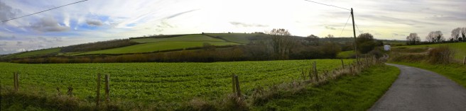
Heading towards Toller Fratrum

The end of the road at Toller Fratrum.
With only four hundred and eighty six acres to be apportioned it might have been thought to be an easy process, nevertheless an award had to be made on the usual basis of the tithes not representing the true value. There were in fact only three owners in the parish, and one occupier. Two of the owners, Thomas Fleming and James Willis were in fact co-owners of 488 acres whilst the other landowner, Richard Brinsley Sheridan, owned just one acre – and that was tithe free by prescription. It may be thought that it was a bit of over kill then, that the actual apportionment was done by Peter Cox of Beaminster, an Attorney at Law. Martin drew the maps but both original and copy are signed by both men. Cox had worked with Martin before, for example on the Maiden Newton inclosure in 1832. In the event Aneurin Owen awarded thirty seven pound to the vicar, Edward Butts.
There are no notes relating to this commutation but in 1838 Martin was involved in surveying “Toller.” He does not mention which of the two parishes this was [see Porcorum below] but the sense of the entries suggests that this was a survey that was being conducted by Edwin with support by his father John. Given the size of the parish it is highly unlikely that the parish was resurveyed and it may be that the map that was eventually submitted to the tithe commission was this one.
|
28th April 1838 |
Went to Toller with Edwin and Mr Richards viewing boundaries etc |
|
Paid Mr Pyne on a.c Expenses at Bridport £5 |
|
|
7th June 1838 |
Went to Toller to find out mistakes |
|
13th August 1838 |
Putting the Office to rights after papering And adding Canvas to the Toller Map writing letters etc and working on Allington Rate |
|
23rd August 1838 |
Adding Paper to Toller Map and Valued Down frome land at Chantmarle |
|
14th September 1838 |
Working on North Poorton Commutation and assisting taking off the Toller Map |
List of Commutations under the Tithe Commutation Act
